The Raroria Atoll

While my original plan was to sail from the Marquesas to the Fakarava atoll, Nature had other plans for me. My wind vane wasn’t working, the TillerPilot was being temperamental, and some nasty weather was on the way. The idea of navigating the dense atolls without a wind vane in inclement weather was not appealing. About one-third of the way to Fakarava I bailed and headed south to the Raroria atoll, which was 100 nm closer. Raroria is known for the location where Thor Heyerdahl’s Kon-Tiki raft arrived after its 101-day journey from South America in 1947. I reached Raroria after dark, so heaved to offshore until morning, when I passed into the lagoon about 8:00, during slack (high) tide. I first went to the small village of Raroria, which has a population of about 200, mostly pearl farmers and fishermen. As it turned out, the once-a-month supply ship had arrived the day before, and the small store was relatively well stocked. I anchored in the small bay with a catamaran that had arrived an hour before me, and took my dinghy to the dock. The dock had a few colorful boats moored to it.

The village consists of a network of narrow concrete roads. Before I went to the store, I took a look around the village. There is an interesting open-air chapel constructed of rocks.

I also visited the cemetery. While there were many graves from the early twentieth century, most of the headstones for those were hard to read due to weathering. There were also some recent graves.

I followed the directions I was given to the store and almost ended up in the living room of a stranger. Although I don’t speak French, the woman figured I was looking for the store and kindly showed me where it was. The couple who ran the store were delightful. They tried to talk me into staying the night because there was always a party on Sarurdays with music and dancing when the pearl farmers on the other side of the atoll returned for the weekend, the party and church the next morning. However, the anchorage at the village was sketchy and bad weather was forecasted. The anchorage is surrounded by reefs and an unmarked wreck, and not much room to swing on anchor in a storm. I decided to move my to the north side of the lagoon, about 10 nm away. And, that was a good decision, because one heck of a gale hit that night.

Check-in May 3, 2025; 01:38 UTC

Current Position: 15 57.155’S 142 19.120W; Local Timezone: UTC-10; HDG: N/A; COG: N/A; SOG: N/A; Distance to Waypoint (Raroia): At Anchor; Total Miles Sailed: 3885 nm;
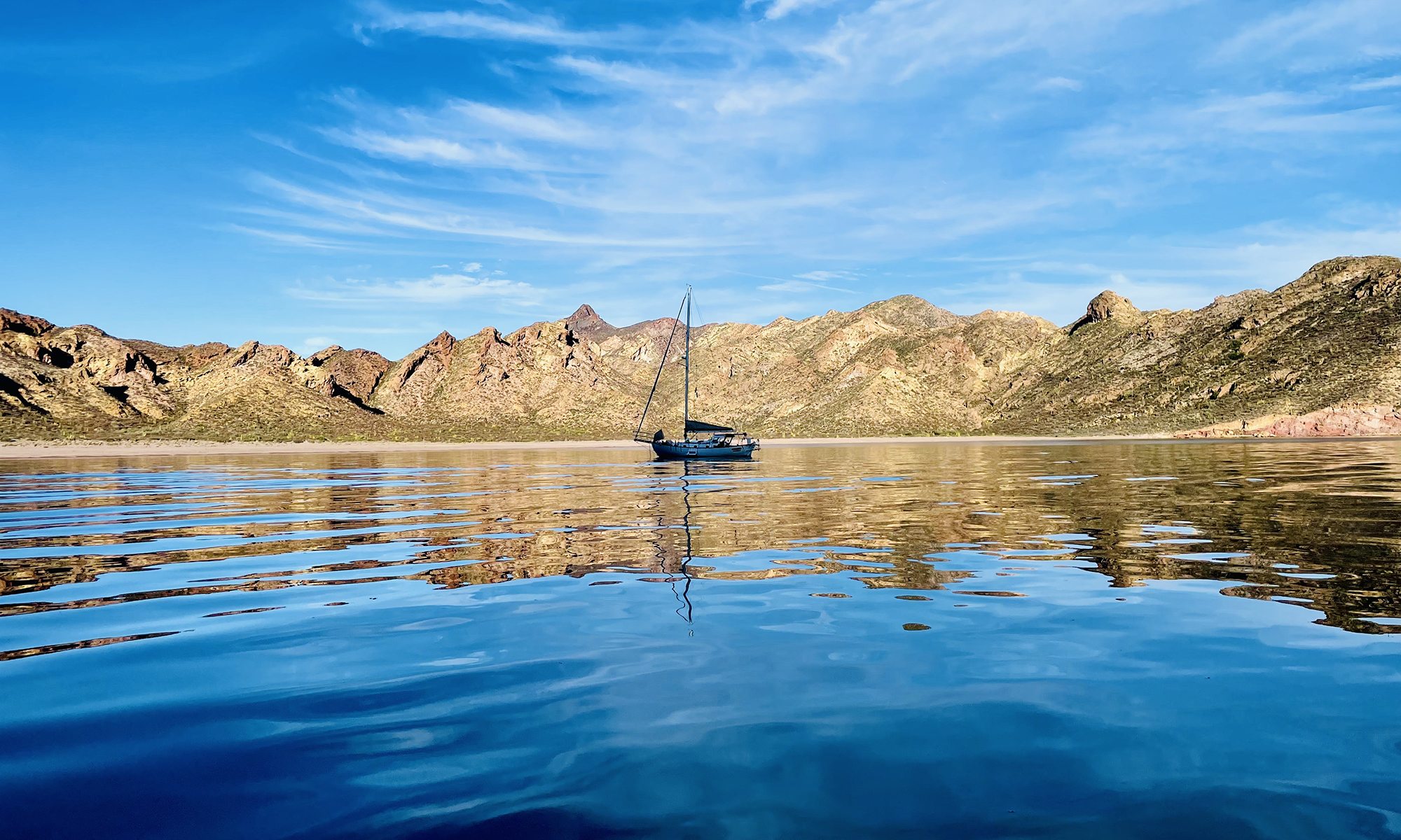
Comments: Sunset was at 17:20. I am still 14 nm from the passage into the lagoon and just west of the smaller atoll Takume. As predicted, the wind is shifting more northerly and is lighter, making progress slow. The waves cause the headsail to flag and the boom the swing. The seas are calmer and there is no threatening weather to the north or east. I reached Trinity at sunset. They gave me advice regarding passage into the lagoon and recommended I make my the 10 nm north to where they are currently anchored. I was told the anchorage is not great by the town and the coral heads are easily seen in the lagoon, especially if the sun is high in the sky. When I was 7.5 nm from the passage, I heaved to. My position was 15 51.963’S 142 27.557’W at 19:09. I was traveling about 1.5 kt at 328, generally away from the atoll. If X is the number of hours I am heaved to, I will be:
(7.5 + 1.5*X) nm from the passage 12-X will be the time I have to sail to the passage
If I can sail at 4 km/h I must be able to sail the first distance in the second time. In other words …
4 nm/h = (7.5 + 1.5X)/(12-X)
Solving for X …
48-4X = 7.5 + 1.5X 5.5X = 48-7.5 X = (48-7.5)/5.5) = 7.3
Checking my work, if I have heaved to 7.3 h, I will be 7.5 + 1.5*7.3 ‎ = 18.45 nm away. And, it will take me 18.43/4 ‎ = 4.608h to sail that distance. 7.3+4.6=11.9h.
Bottom line is I should sleep 5h then plan to sail back to the passage. Note, I could have lowered the sails instead of heaving to, but under bare poles the wind would have pushed me towards the reef, not away from it, so what I am doing is safer. Before going to sleep, I checked the chain locker to make sure the chain was in order. I set periodic alarms. At midnight I determine I am drifting closer to 1 rather than 1.5 kt. At 3:30 I got up and made some chai tea. I was 15 nm from the passage. At 3:50, I set sail for the passage with the double-reefed main and half the Yankee. I was making 4 kt. Sunrise is in 90m. By that time I should be close to where I was when I heaved to last night. It is dark … no stars or moon. It is a strange feeling sailing towards a reef in the darkness. Another boat, “XIII”, apparently a 56’ sailboat is between me and the passage, very close to the atoll and perhaps 5 nm from the passage. Another one, “Lulu”, is 70 nm away following the same course I took to get here. At 4:45, the wind was lightening up, I’d say 8 kt from the NE, so I unfurled more of the jib to make a little over 4 kt. The wind picked up at sunrise (5:30), which was spectacular. I am doing 5 kt and I have 9.5 nm to go to the passage. The weather to the east looks threatening. I can see a squall is passing behind me, which is probably the source of the new-found wind, which is driving the boat 5.5 kt. At 6:00, I am essentially back to where I was last night, 7.5 nm from the passage, which ai am schedule to reach about 7:30. At 6:00, I turned the Radar on and confirmed the accuracy of the charts. I see the squall behind me on the Radar, but nothing else threatening. I am 7.2 nm out, essentially the same distance I was when I heaved to last night. I can see now my waypoint is about 2 nm from the passage and XIII is about 1 nm offshore when it turns at 6:10, not towards the passage but away from it, turning 180 degrees to head up into the wind, presumably to drop sails. At 6:15, I spot land, motus, the palm-fringed mini-islands that circle the atoll. It has been strange to be so close and not see anything, but then the whole atoll is the height of a coconut tree. At 6:20, XII turns to enter the passage. She follows the waypoints Bandit gave me exactly. I notice she gives the reef on the north side of the entrance, the one Trinity told me about, a wide berth. I am about an hour away from my waypoint. At 6:35, XIII has made it through the passage and is turning SW (200) towards the village, still following the waypoints. At my last waypoint (R7) she continues straight for about 2 nm before anchoring. Since the wind was light and I had two reefs in the main, I didn’t round up when I reached my outer marker, but just started the engine, furled the jib, and dropped the main while still under autopilot, which was directing me where I needed to be to avoid the reef anyway. The green seems out of place. I reached the outer marker at 7:40. From about a mile and a half out, I motored through the passage, following the waypoints. The channel was larger than I expected. The sails were stowed and secured by 7:50, about one mile from waypoint R1 and under motor at 5 kt. It seems I will pass into the lagoon exactly at high tide, just in time as there are squalls coming. A quarter mile from R1, I disengaged the autopilot and hand-steered. As I entered the passage, I could see the motus on the other side of the lagoon. There were markers in both sides of the entrance to the channel. I could see water coming over the reef to the left. There is a second reef in front of you as soon as you cross the barrier … hence the sharp right turn. There are standard red/green markers after that showing the water the anchorage at the village. The first green one marks a boomie, so stay to the left. In fact, all of the green and red markers are on top of boomies. The anchorage is in 35-40’ of water. It feels dicey as I cannot pay out enough chain because of a reef behind me. I want to check out the village. The once-a-month supply ship arrived/departed yesterday and so the store is supposed to be stocked. I met several nice people in the town , including a woman, Karen, whose home I thought was the store. When she understood what I was looking for, we both had a laugh about me inviting myself into her living room. She kindly showed me where the store was. I stocked up on some things, went back to the boat, and hauled anchor just as to more large catamarans were arriving. I navigated the 1 1/2 nm channel then headed out across the lagoon for the 8 1/2 nm trip to the north side. There is no way all four of us would have fit safely at the anchorage. I was hesitant to move. It was squally, which was of course precisely why I needed to move. I thought I might be difficult to see the coral heads without sunlight, but they stuck out like turquoise patches on the grey water. The only way to navigate across the lagoon single-handed was to put the boat on autopilot and sit out on the bow, going back to the cockpit to divert the boat when I spotted coral. The threat was real. I would have hit a dozen coral heads had I not spotted them. About halfway across the lagoon a squall hit. There were high winds, but not rain. Since I was not sailing, it was not an issue, except waves were kicked up in the lagoon and I was sprayed with seawater while sitting on the bow. Shortly after that, about two-thirds of the way across, I had to take quick action to avoid what appeared to be abandoned fish traps. I arrived at the anchorage about 2:15. Two boats were leaving as I arrived, leaving five boats to my port and two to my starboard. However, the boats are spread out hundreds of yards apart. As I was setting the anchor, two black-tipped sharks joined the party. B I just cannot imagine a more beautiful place than this … angry grey skies, turquoise water, green palm trees and white sand. This may be the best place I visit on my trip for diving, so I’m going to spend some time here. There is an issue with my AGM battery bank, Alternator, or DC-DC charger. The AGMs are charged (13.08 V), but the “input voltage” to the DC-DC charger is only 8.51 V, so the alternator did not charge the lithium bank during the crossing. This is an issue because there was no sun today and the lithium bank was used hard over the past 24h for Radar and autopilot. While I was trying to figure this out, I was hit by the hardest-driving rainstorm in awhile. The timing was good, because I needed a shower, but the water was very cold. Returning to the DC-DC problem … I believe I have found the issue … a short between the input wires. This was draining the starter battery bank. When things cool down in the engine room (after motoring), I will fix the problem (tomorrow) and run the engine to make certain the system is working and to charge the main battery bank. Even during the storms, the boat does not rock a bit. This means I have three things to fix here …
The wind vane The DC-DC charger The wind instruments at the top of the mast
I think this is going to take me a couple of weeks.

Check-in May 2, 2025; 00:14 UTC

Current Position: 15 34.095’S 142 20.881’W; Local Timezone: UTC-10; HDG: 187 COG: 190; SOG: 4.4 kt; Distance to Waypoint (Raroia): 25; Total Miles Sailed: 3835 nm;
Comments: I watched the large squalls I avoided late yesterday pass behind me in the setting sun. At dusk, I slowed the boat down to 3.5-4 kt to let some more squalls pass in front of me. As they did, despite being having only half the Yankee deployed and a double reef in the main, the wind picked up to drive the boat 7 kt. Sunset was about 17:15. Soon after that I passed within 15 nm of a small atoll, the only real obstacle between me and Raroia. For a change, the TillerPilot operated flawlessly, and I would have slept through the night if not for the 2h periodic alarms. The wind was stiff but the seas relatively calm, so I travelled at 5.5 kt with little sail, little heeling, and little rolling. One of the most pleasant nighttime sails. At midnight I went to the cockpit. There was no moon or clouds. I turned off the running lights for a minute and looked at the stars. I was headed straight for the southern cross. At 14.5 degrees south, I took note that it was cooler than a few weeks ago when I crossed the equator. The last course I plotted with PredictWind was at noon. Despite reducing sail and attempting to slow down, I was ahead of schedule for an arrival of 18:00, right after dusk, and perhaps 2.5h after low tide. The tide would be coming in through the pass. It is highly unlikely I will arrive before dark, and there is no way I am going to try to navigate through the unfamiliar pass in the dark, so I am going to have to make a decision tomorrow about where to heave to. There is a smaller atoll to the north of Raroia that needs to be avoided. The eastern side of Raroia is supposed to be treacherous … it’s where Thor Heyerdahl’s Kon-Tiki raft arrived in Raroia after its 101-day journey from South America in 1947. I will need to heave to on the west side, where the pass is. The wind is supposed to die down tomorrow night and blow more northerly. I will need to check the currents, but it may make sense to sit bare poles NE of Raroia and drift south until Saturday morning. I note the S/V Trinity (the one that contacted me earlier in this passage) is anchored where I intend to, so I will reach out to it when I am within VHF range. Sunrise was about 5:40. It was partly cloudy without any immediate threats. As best as I can tell, there were no squalls last night. Despite relatively light winds and a minimal sail plan, I have still averaged over 5 kt overnight. A small squall passed behind me at 6:00, increasing the wind a bit and bringing a light drizzle. Because my instruments were down at 9:00 yesterday, I was unable to record my location or progress, so I have no point of reference for today, and by 9:00 tomorrow, I should be at anchor. About 9:00, there was a gentle rain and I rinsed off. I celebrated by eating the last apple I purchased in Nogales seven weeks ago. It was still in pretty good shape. I still have one from Cabo and another I bought in Hiva Oa. Unfortunately, I had to toss out 2 1/2 baguettes that were getting moldy after four days at sea. They looked surreal floating on the water. It is 14:00 and I am about 25 nm from the passage into the Raroia lagoon. I am about 10 nm from the waypoint that I intend to heave to. At that point I will contact Trinity. I will set periodic alarms tonight and move within 5 nm of the passage before daybreak (5:40), about 2h before slack tide. About 7:30, I will position myself close enough that I can study the water with binoculars before actually entering. I don’t expect there to an issue because the winds are supposed to be relatively light tonight, but sometime the winds can interfere with slack tide by driving water over the atoll.

Check-in May 1, 2025; 01:08 UTC

Current Position: 13 45.774’S 141 41.654’W; Local Timezone: UTC-10; HDG: 184 COG: 190; SOG: 5.3 kt; Distance to Waypoint (Raroia): 142; Total Miles Sailed: 3718 nm;
Comments: Sunset was approximately 5:20. It looked a bit squally ahead, so I turned the radar on. Indeed, there was a storm about 8 nm ahead of me, but I do not believe I will be significantly impacted by it. The wind picked up after sunset. At times I was doing 7 kt. The TillerPilot alarm went off every 10-30m all night as it struggled to keep the boat on course. I sometimes ignored the alarm if I seemed to be on course. Once it woke me and I found the boat had heaved to. A rain storm hit at midnight. I turned on the radar to assess the threat. I was located on the southern leading edge of a 12 nm-long squall line that was presumably traveling east, so I tried to ride it out. The boat slowed from 7.5 to 3 kt as the storm passed. Sunrise was about 5:35. It is partly cloudy and no threats. The boat is making 6.5 kt to Raroia. I’ve discovered one of the issues with the TillerPilot. It must be getting multiple commands from the NEMA2000 network. For example, there are three compasses on the network: the CORTEX AIS, the Precision-9 compass (where all of the instruments should be getting their information from), and the internal compass in the TillerPilot (which is inaccurate and should not be used). The TillerPilot is switching between the last two. When it is using a heading for from the Precision-9 and it suddenly switches to its internal compass, it becomes confused and goes off course. At 8:30, almost all NEMA2000 electronic went offline. I shut down the power and opened the main panel. The wiring was hot. I disconnected the elements of the network to find out which is the problem. The TillerPilot is operating independently while U work and I broke out the analog compass to make sure I stay on course. I confirmed the TillerPilot does not draw current from the network. Here are my findings by component for the first zone:
Zeus 3S Chartplotter – 0.1 Ah Two Triton 2 displays – 0.2 Ah Remote Autopilot Control – 0.2 Ah
All of the above, but isolated from the rest of the network draws 0.4 Ah and the wires are not hot. There are basically two more zones, a backbone in the radio compartment to which the VHF, AIS, and the PW DataHub are connected, and a backbone under the settee to which the two boat speed sensors, depth sounder, compass, and wind instruments are connected. The three backbones are daisy-chained, so I cannot really isolate each component, but many have separate breakers. I isolated the second and third backbone. When I plugged in the second backbone, it drew 15 Ah and blew the 10 Amp fuse in the first backbone. There were eight cables going into the second backbone:
Cable from first backbone Cable to second backbone AIS DataHub Ethernet Fuel level sensor Fuel management dongle NEMA 183 adapter for the TillerPilot
It was the TillerPilot cable that was drawing the 15 Amps. Since the communication with the TillerPilot is faulty anyway, I left it unplugged and will use it in stand-alone mode. The system is working again. During the three hours it took me to disassemble, test, and reassemble the NEMA2000 system, the TillerPilot worked fine on its own. No alarms, no course deviations … just plugging alone. I suspect the short in the TillerPilot NEMA182 cable has been the origin of a lot of problems I’ve had with it. The wind lightened up in the afternoon so I shook the second reef out about 13:30. I was making about 5.5 kt toward the waypoint at 186 with 150 nm to go. At 14:30, squalls appeared to the east. Radar showed four. The ones at 9 nm would probably miss me, but the two at 3-5 are likely to hit, so U am reducing sail. I managed to reduce the jib to 50% and put the second reef in before the first squall hit me square on. I went out and got a shower. The boat was doing 7 kt beam reach, but was in heeled over 5 degrees. I can see more squalls developing. It’s going to be one of those nights. I am leaving the sails reduced. I have made 133 miles towards Raroia in the last 24h. I expect to arrive tomorrow evening, but will have to wait until morning for slack tide to enter the lagoon.

Check-in April 30, 2025; 01:32 UTC

Current Position: 11 41.616’S 140 55.604’W; Local Timezone: UTC-10; HDG: 181; COG: 188; SOG: 5.1 kt; TWS: ?; TWD: ?; TWA: ?; Distance to Waypoint (Raroia): 274; Total Miles Sailed: 3597 nm;
Comments: Note I am in a new time zone.The gusts increased in frequency and speed as sunset approached, driving the boat at 6.5 kt. The skies were partly cloudy and nothing looked threatening, so I left the main with a single reef and the Yankee fully deployed. I had an alarm set to retrieve my fishing line at dusk. When the alarm went off, I thought to myself, it’s been awhile since I caught a fish. Moments later, the struck indicator went off. I could tell it was not a small fish (it was taking my line with full drag), so I heaved to and tired the fish before landing it. It was a good-sized tuna, certainly a week’s worth the food. While I was cleaning the fish, I received a VHF call from S/V Trinity, a 46’ multihull doing 10 kt about 19 nm away. They had noticed that I had altered course and speed (because I was heaved to) and wanted to make sure I was okay. I explained I had caught a fish, which they congratulated me on before continuing on their way. When I got back underway, the wind had picked up … I am guessing 15-18 kt. The boat was doing 7-7.5 kt with the single-reefed main and the full Yankee. I had trouble getting the wind vane to keep me on course. The problem was periodic wind gusts that would cause the boat to round up to 180 (from the desired heading of 210). When the gusts stopped, the wind vane would over correct, setting a heading of 240, presumably because I had weather helm because the main was reefed and the jib was fully deployed. In the end, the TillerPilot was used. It had the same problem, but corrected faster, so the swing was more like 15 degrees rather than 30. Nonetheless, the TillerPilot’s alarm went off every time there was a gust because its arm had been fully extended and the course had not been corrected to 210 (it was more like 200). The alarm went off every few minutes and sometimes the TillerPilot could not correct itself, so I would have to get up. To try to address the issue, I tried to better balance the sails by furling in half the Yankee. This seemed to help. However, while trying to set up the TillerPilot, it stopped working. I would engage it in auto mode and it would immediately kick out to standby mode. I tried to reboot it, but the problem persisted. Finally, I check the deck-mounded plug and sure enough it was corroded. I did a quick clean and it started working again. When I have time, j will clean it better and pack it with dielectric grease. It was 2:00 before I got to bed. I woke at 6:00, nearly sunrise, with the alarm on the TillerPilot going off. The alarm is on the unit itself and not the main siren, so it is not as loud. The course was 195 (instead of an ideal 210). That seemed to be where the trim of the sails wanted to point the boat, so I reset the course to 200 to turn the alarm off. My goal today will be to try to evaluate the Monitor wind vane so I can report to the company and solicit a fix. It is partly cloudy. None of the clouds look particularly threatening, but there is the potential for a squall. My 9:00 check showed I made (570-455) 115 nm on, which is not bad considering all the difficulties I have had. The current forecast is for storms on Saturday the 3rd and Sunday the 4th (when I am supposed to arrive). Also, easterly winds are going to become northerly, making it difficult to get an angle on Fakarava unless I loose some latitude. Right now, the TillerPilot is only happy on a course of 230 or 180 (less than 239 and it rounds up to 180). I need to get as much rest as possible before Saturday, when I start navigating the atolls and will need to be awake most of the time. My plan is not to enter the atolls is foul weather … to either back off on my speed or plan to heave too and let the weather pass. About 10:00 is started to feel squally. It got grey, started to sprinkle, and the wind picked up. Especially as I expect to slow things down past the weekend, I put a second reef in the main. The boat handled better and I was still making 5 kt with only a sliver of Yankee. The boat seemed stable on a heading of 200-210 (waypoint 209), so I went below to take a nap. I laid down 45m, checked the weather and my route. Storms are predicted Saturday and Sunday when I would be navigating the atolls without reliable autopilot. I have made the executive decision to bail on Fakarava and make my way to Raroia, which is more than 100 nm closer and does not require me to navigate atolls. It is 1:00 local and Raroia is 290 nm away. If I can average 5.5 nm/h (probably not), I can be there before dark on Friday, before the storms are scheduled to arrive. If I don’t make it before dark, I can heave to and come I at first light Saturday. PredictWind has me arriving Saturday, but I have a very conservative model at night (only 3.5 kt). I am currently doing 5.5 kt with a double-reefed main and 80% of the Yankee on a heading of 188 to Raroia. The TillerPilot has stopped communicating with the chart plotter altogether. I tried cleaning the plug contacts, which worked before, but no luck. Fortunately, the TillerPilot can work independently, just no Nav or Wind mode. I fixed myself a healthy portion of the tuna … not going to run out anytime soon.

Manifesting a Bigeye

I have not caught any fish since the Dorado I caught before crossing the equator. Honestly, I have not been fishing much, but I had a line out yesterday. As dusk approached without any bites, the alarm I had set to retrieve the line went off. A good way to lose a rig is to leave it unattended overnight. When the alarm went off, I thought to myself that it’s about time I caught a fish. As I reached for the pole, the strike indicator went off and the line started paying out uncontrollably. I put full drag on, but it hardly slowed down. I quickly heaved it to take some pressure off the line and I played the fish until it was tired enough to gaff. I had caught a Bigeye Tuna. Before the sun sat, I cleaned the fish, producing enough meat for several weeks. While I was working on the fish, I received a VHF call from S/V Trinity, a much larger and faster catamaran that was about to overtake me. They wanted to know why I had stopped and offered assistance. I explained I had caught a fish. Their reply (in my best Australian accent) was “Good on ya, mate. Cheers!.”
{CAPTION}

Check-in April 29 2025; 01:49 UTC

Current Position: 10 25.222’S 139 31.937’W; Local Timezone: UTC-9 1/2; HDG: 214; COG: 220; SOG: 4.5 kt; TWS: ?; TWD: ?; TWA: ?; Distance to Waypoint (Fakarava): 533; Total Miles Sailed: 3474 nm;
Comments: I woke about 2:00 to the sound of the chain being strained. A strong offshore breeze had developed and I had not paid out enough chain to properly set the bridle. I let out some more chain and went back to sleep. It was 6:15 when I woke up . I had slept nearly 11h … very unusual. There were no flies, meaning what the other’s experienced was an unusual swarming event or my fly evasion plan worked. The wind was still blowing strong offshore (from the west, opposite the prevailing trade winds). I made a large batch of chai tea for the passage. The last time I made some was in Mexico. At 7:40 a catamaran appeared on an obvious heading to Tahiti. It encouraged me to stop sipping tea and get ready. I had a few chores to do. I loosened the bleed valve on the engine fuel filter and confirmed there was no air in the line. I still had a leak in the dinghy, apparent through one of the bolt holes for the wheel mounts. When I examined the bolts, it was clear from the stains which two were leaking. I applied chalking to it to allow it time to dry before I used the dinghy again, stowed everything, and pulled anchor at 9:00. As I left the wind shadow of Tahuata, the wind was strong (about 15 kt), but it became variable until I was well clear of the leeside of the island. At one point I was in nearly flat water with no more than a couple of kt wind, but I could see whitecaps a couple of 100 yards out, indicating 15 kt winds. Eventually, I settled for 5.5 kt boat speed in a near beam reach with one reef in the main and most of the Yankee showing. Heeled 10 degrees, it didn’t make sense to present more sail. In the first 3h, I averaged 5 nm/h on, but much of that time I struggled with getting the wind vane to control the boat. I don’t know if it is the new control lines (that are slightly larger diameter, or perhaps the wind vane was tweeked. After studying it for a few hours, it became evident the vane was not freely flapping. There was resistance that wasn’t there before. Although the manual states that lubricants should not be used, I put some PB Blaster on the meshing gears and worked the vane back and forth manually. That seemed to help and I started to being able to hold course, although the wind vane did not react as quickly as it used to. I feel with continued use it will start freeing itself up. Part of the difficulty in finding out what is going on with the wind vane is it has been gusty all day, and the change in wind speed naturally affects the wind vane. It is a bright sunny day, so I started to make water about 1:00. After a passage from Mexico to the Marquesas that was marked by squalls and pounding seas almost every day, it is very nice to be sailing in sunshine and calm seas. The wind vane has almost working well again. It still has troubles when I am moved way off course by a wave or gust of wind. I’m going to use it overnight, but set alarms every hour to make sure I’m on course.

Check-in April 28 2025; 00:43

Current Position: 9 57.747’S 139 p7.108’W (Hanamoenoa Bay, Tahuata) Local Timezone: UTC-9 1/2; HDG: N/A; COG: N/A; SOG: N/A; TWS: ?; TWD: ?; TWA: ?; Distance to Waypoint (Fakarava): 570; Total Miles Sailed: 3435 nm;
Comments: I got up early and did things to ready the boat. I rechecked the cabling for the wind instruments and I am pretty certain the problem is on top of the mast, either the connectors or the instrument itself. I can’t help think it is not a coincidence that the wind instruments failed when I stared using the spinnaker halyard as the main halyard (wrapping it around the top of the mast). I am going to have to wait until the boat is steadier before checking it out. I went to the service station when they opened at 7:00, got 15 gallons of diesel and topped off the gasoline . I am tax-exempt because I am transiting through French Polynesia, so I saved about $1/liter in taxes (about $60), almost half the cost. I also bought some provisions (eggs, French bread, etc.). By the time I returned to the boat, stowed the stuff, got the outboard and dinghy aboard, readied the boat, and hauled anchor, it was 9:00. It was only 14 nm to Hanamoenoa Beach on Tahuata Island, but I had to zigzag through the channel that separated the two islands. Since half the distance was on the leeward side of Tahuata, I just motorsailed with the jib. I couldn’t get the engine over 1400 rpm for some reason. It seemed starved for fuel. It may have something to do with the fact that I overfilled the day tank and it could be that the vent line is clogged. Or, it could be that I didn’t sufficiently bleed the line, especially the engine fuel filter. It was a good call to motor sail. The seas were very rough in the channel and the winds variable. It would have been difficult to sail through it (and not worth the effort for such a short distance). Also, motoring revealed the issue that needs to be addressed with the engine. As expected, the leeward side of the island was relatively calm and the winds light. Since the engine was running, I made water during the hop to the new anchorage. All around the island, the shore was dotted with buildings. I did not see any roads, so transportation is presumably by horse or sea. I arrived at the anchorage at noon. There were two boats anchored already and a third would arrive later. I was warned by people already there that the black flies were horrific after dark, and under no circumstances should I have any lights on. Then they showed me a photo of their deck that was covered with a carpet of flies so thick the deck was black. I dove on the boat and cleaned the hull of razor clams. Unfortunately, there must have been jellyfish because I got some painful stings on my feet, where the fins were. Still, it’s the first time I’ve been in the water in a month (Hiva Oa’s bay was too dirty), so it was worth it. There was a small village with a dock that I was tempted to visit, but between the flies and jellyfish, the anchorage is not very nice (although esthetically beautiful). I am spending the afternoon cooking meals for the passage and will plan to leave for Fakarava early in the morning. I love the pressure cooker … 15 minutes of propane and I’ve made a lentil, vegetable curry. It’s a 5 1/2 day passage to Fakarava, and the wind is supposed to die down towards the end. The final day is a bit tricky as there are atolls to avoid, and ideally I would arrive at the north (Garuae) passage early in the day, to give me plenty of time to find a safe anchorage (free of coral heads). Fakarava has restricted the anchorages to five locations. The rules are changing all the time. I have read you basically have to visit Rotoava to pay the fees and learn what the current rules are. By 14:30, two of the boats had left the anchorage in search of less fly-infested waters. However, my plan is no lights at night, portholes closed, and the screen in the companionway, then exit the cabin and weigh anchor after the morning sun has driven the flies away. The black flies started arriving as soon as it got cloudy at 15:20.
Sent from my iPhone

A Birthday Party on Hiva Oa

I was invited to the 70th birthday party for my friend Pifa’s father, Robert O’Connor. It was held yesterday at the O’Connor homestead on the north side of Hiva Oa. Pifa picked me up at the dock and we drove very slowly to the party as we were in charge of getting the cakes there in one piece. As we arrived about 11:00, some of the men were just removing the cow that had been roasting over an open fire, in the background, since 4:00.
While the men made quick work of carving up the beef, the woman decorated the cakes with chocolate and coconut. I took the opportunity to check out the “O’Connor Bay”, with its black sand beach. The compound consisted of a dozen structures up the canyon behind me in this photo.

There were seven cakes, one for each decade, and each had a photo of Pifa’s father in that decade.

There were many photos taken. This one is with the father and some of his twenty brothers and sisters. All that lived nearby attended, but many who like in Tahiti, France, and elsewhere could not.

The festivities were lively, with loud island music and dancing, including many spontaneous haka dances, which were different than the Maori haka I was familiar with from my time in New Zealand, particularly in the gutteral ”wild pig” sounds.

Besides the beef, fresh raw fish, cooked whole shrimp, and many rice dishes were served. The Mormon side of the family drank fresh juice and the Catholic side mostly beer.

Before I left, Pifa’s mother Ziella made sure I took some leftovers … including two pieces of cake. It was as a fabulous experience that I will not soon forget.

Sent from my iPhone

Check-in April 26 2025; 2:51 UTC

Current Position: 9 13.463’S 138 07.952’W (Hiva Oa) Local Timezone: UTC-9 1/2; HDG: N/A; COG: N/A; SOG: N/A; TWS: ?; TWD: ?; TWA: ?; Distance to Waypoint (Hiva Oa): at anchor; Total Miles Sailed: 3422 nm;
Comments: it was my plan to finish my chores and leave Sunday, but I have been invited to Pifa’s father’s birthday today at the family compound in the north side of the island. It is an opportunity I cannot pass on. It may still be possible to leave Sunday, perhaps later in the day. I got up early, cleaned the bilge, replaced the control line on the wind vane, epoxied and screwed together the dorade box. Pifa picked me up about 9:00 and returned me to the boat about 16:00. It was a remarkable cultural experience that I will describe in a separate post. The gas station is not open on Sunday, so I will prepare the boat tomorrow, pick up diesel when the station opens at 7:00 on Monday, then sail to Hanamoenoa Bay on Tahuata Island, about 10 nm away. I will stay two nights, make water, clean the hull, and do some cooking for the passage to Fakarava Atoll.