My Next Destination

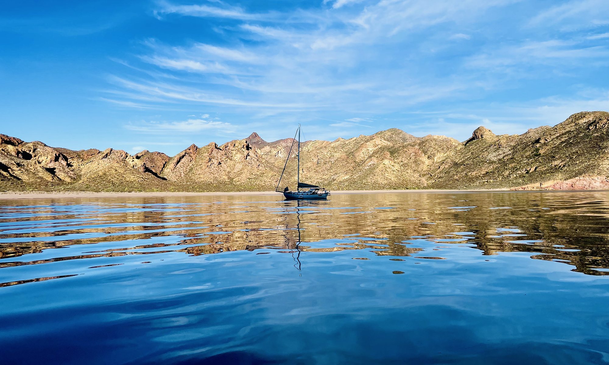
The last document you obtain as part of the formalities of leaving a country is a Zarpe. In the context of maritime navigation, “Zarpe” refers to the official clearance document needed to leave a country by boat. It’s a Spanish term that translates to “set sail” and is commonly used in the boating community. In some countries, obtaining a Zarpe is a requirement for legally leaving, and it’s often a document that needs to be presented upon departure from a port. As important, it is a document that is expected at your destination. I have obtained only one so far, when I left Mexico. I described the ordeal in a blog post. I am about to leave French Polynesia and I am working on getting my second. To obtain the Zarpe, I have to know where I am going. So, all day I have been giving that issue some thought.

To keep to my schedule, which is necessary if I am going to be in position to transit the Indian Ocean this season, I have to sail about as many days as I am at anchor. However, the number of days I am at anchor can be out of my control. For example, I have a punch list of things I need to do before I leave Tahiti that incudes a half dozen boat repairs. However, another time sink are the formalities … the paperwork. For example, It takes a minimum of one day to check into Tahiti and a minimum of three days to check out. Which brings me back to the issue of my next destination.

I published a proposed route last year. To help me decide my route going forward, I explored two issues: 1) how long does it take to get there and 2) how complicated are the formalities. Starting with the the time it takes to get places, I calculated the distances between destinations I am considering and created a spreadsheet. Calculating the distance between two points on a sphere is not simple. For that, we turn to Haversines Formula, where the Earth is approximated as a sphere. I used Excel to do the calculation, first by entering the latitudes and longitudes for the locations (using conventional signs for N/S and E/W), converted the degrees to radians, then transposed the matrix:

Note I have chosen to use the radius of the earth in nautical miles (3444 nm). Next I created the equation for the Haversine Formula in cell A15:

=ACOS(SIN($D7)SIN(G$4)+COS($D7)COS(G$4)COS(G$5-$E7))$B$1

Finally, I copied the equation into a 7×7 matrix, which was then automatically populated with the distances between the seven locations under consideration:

Using these data, I could compute the distance I would sail for various routes. If I assume an average 4 kt speed, I can then estimate the time I would be sailing. If I assume I’d spend about a week at each location, then I could estimate the time on land for each of the routes. The sum of these two would represent the total time. The difference between the total times for each route would be the time saved.

The first thing you notice is there is a difference between the first two distances (about 2700 nm) and the next three (about 2500 nm). The reason is the Cook Islands and Samoa are about 13 degrees S and Tahiti, Tonga, Fiji, and Vanuatu are about 16 degrees S. Going N 3 degrees and then ack S again (6 degrees total, about 360 nm) costs half a week in sailing. Second, you can save as much as a month by not making extra stops.

Of course, time is not everything. These locations are paradises. But, I would rather spend three weeks at one paradise than rush from one to the next. After reading about the Cook Islands (and hearing from a friend who is there now), it sounds like the formalities are a hassle. Samoa also has a reputation for a lot of paperwork. On the other hand Tonga is supposed to be very inviting and I am very much attracted to the 170 islands that make up Tonga. Visibility is supposed to be 100′ in the water. I would certainly save 2 1/2 weeks going there directly, and probably more realistically a month. Further, Tahiti is a great place to resupply, whereas the Cook Islands and Samoa not so much so. Finally, there is the fatigue factor of getting the boat ready for a long passage and making that transition from being at anchor to being at sea. My decision is made … I will be heading to Tonga next.

Remarkable Weight Loss

I was invited for “sundowners” yesterday evening by S/V LuLu and the subject of health came up. My hosts noted they had lost weight and generally felt less fit. When I returned to the boat, I weighed myself, the first time since I left Mexico. I am 178. I was 225 when I quit my job three years ago … 47 lbs difference. I am at the weight I was in high school, not through any concerted effort to diet, but simply through my lifestyle. Most of the weight came off in the first year or so after I stopped working. Instead of sitting behind a desk, I was working on and sailing my boat. When I began this current trip almost two months ago, I was perhaps 190 or so. My diet has not changed that much except in one respect, I do not drink any alcohol when I am sailing, although I do when I am at anchor, perhaps 25% of the time. Otherwise, my eating habits remain largely unchanged, I eat one large meal in the afternoon. So, I attribute the weight loss since leaving Mexico (perhaps 15 lbs or so) to the alcohol. Also, I am constantly exercising at sea, keeping my balance and flexing to react to the pitching and rolling of the boat. I feel healthy which is the most important thing.

Captain’s Log] Check-in April 19 2025; 20:04 UTC

Current Position: 9 13.463’S 138 07.952’W (Hiva Oa) Local Timezone: UTC-9 1/2; HDG: N/A; COG: N/A; SOG: N/A; TWS: ?; TWD: ?; TWA: ?; Distance to Waypoint (Hiva Oa): at anchor; Total Miles Sailed: 3342 nm;
Comments: I arrived at waypoint #27 at 23:30 (UTC – 9 1/2). Up to then, I had been setting alarms in my iPhone every hour as I got closer to the waypoint. However, my iPhone did not wake me up. The alarm on the navigation system went off announcing I had arrived. This was a surprise to me as I expected it to be another half hour. The reason is the iPhone had picked up cellular service and changed its clock to UTC – 9 1/2, so the phone thought it was 23:30. There is a difference between an “alarm” on the iPhone (which is set to a particular time) and a “timer” (which simply counts down the minutes). I will be staying awake until I drop anchor. The skies are clear. The moon is over my left shoulder. I entered the channel on a heading of 234 and a speed of 4.6 kt, still with half the Yankee and a double reef “in the main. According to the forecast, I may loose some of my wind in the channel. The plan is to sail diagonally past Cap Metafenua and do a single jib to the anchorage. At 0:15 i spotted land. I turned the radar on to confirm the accuracy of the chart plotter. At 0:30, I am about 14 nm from waypoint #28, the point at which I expect to jib.!I should arrive there about 3:00, depending on the wind. I’m happy the weather is tame … maybe 8-10 kt wind and relatively calm seas. I arrived at the waypoint to jib at 3:15, but decided to wait until I had a 90 degree jib angle. As I approached the point to jib, I could see the lights of Atuona, the anchorage, about 10 nm away. At 3:40 I jibed with a new heading of 313 and a distance of 9.5 nm. The ETA was for about an hour after sunrise, which was the plan made two days ago. Sunrise was at 5:49. I am 2.8 nm from the anchorage. There showers around the anchorage. I will lower the sails about 1 nm out and motor in the rest of the way. Of course, there had to be some last-minute drama. The first time I went into the anchorage, my engine throttle failed. It was stuck in the forward position because a bolt algae jiggled loose. I went out to sea and fixed it. The second time I came in, I tried to drop the anchor and the windlass did not work. I went to sea and fixed it (I must have accidentally switched off a circuit breaker in the chain locker while organizing the chain). The third time was the charm and I anchored just outside the breakwater, because there did not appear to be room on the other side of the breakwater. An hour or two later, two boats left, and I took one of their places inside the breakwater. That’s important because I need to go up the mast, and I don’t want to try that again if the boat is pitching.

[Fishing] First Dorado

I’ve caught a lot of fish while sailing in the Sea of Cortez. However, sailing season in the SOC is generally during the cooler months. I spent the summers working on the boat. Being a warm water fish, I’ve never caught a Dorado until now. I haven’t been fishing much during this trip because the seas have been rough and it’s no fun cleaning a fish on a pitching deck. A week ago, I had a line out, but something bit clean through the steel leader. It was so nice today, I put a line out and caught this perfect-size fish in about 30 minutes. You don’t want to hook a monster that is going to take all your line. Even a medium-sized fish is a hassle because you usually have to stop the boat to land it. However. This little guy was small enough that I just reeled it in. And, it produced two meal-sized fillets … just right for a single-handed sailer because you don’t want to eat the same fish for three weeks (and I have done that in the past.
{CAPTION}

{CAPTION}

Check-in March 19, 2025; 16:29 (Local)

Current Position: 24 3.582’N 109 47.467’W (Ensenada de Los Muertos); Course: At anchor; SOG: N/A; BSPD: N/A; TWS: 24.0 kn; TWD: 350 degree; TWA: N/A; Distance to waypoint: N/A;
Comments: I reorganized the boat today. There was too much weight in the bow and on the starboard side. Most of the weight on the V-berth was lowered below the waterline and centered. I also reorganized the food stores to make them more accessible. The reorganization now gives me easy access to all of the sails in the V-berth. There were too many items that were not properly secured. I installed seven new pad eyes and straps to tie everything down. Tomorrow will be the last day for northerlies, so I will head 46 nm south to Los Frailes where I will wait for a weather window to head to the Pacific.
Sent from my iPhone

New Circumnavigation Route

I recently updated the route I would like to take beginning March next year. Details are now available on this website: PROPOSED CIRCUMNAVIGATION ROUTE. Particularly time consuming was researching the clearance formalities of each country and details concerning each port/anchorage, which are now available as hot links on the webpage. One advantage of archiving the information on my website it the information will be available offline when I do not have access to the Internet.

The timeframe is ambitious, basically if everything worked out perfectly and I hit all of the weather windows. More likely, I will need to season out at least once. There are a few details missing yet and I will continue to modify/update the webpage. Eventually, the information will be updated with the actual dates and routes taken.

March to July 2025 (8,240 NM, 55 NM/Day)

August 2025 (2,160 NM, 72 NM/Day)

September-November 2025 (5,156 NM, 57 NM/Day)

December 2025 – January 2026  (3,639 NM, 60 NM/Day)

February 2026 (1304 NM, 46 NM/Day)

March 2026 (? NM, ?NM/Day)

Fjords and channels of ChilePuerto Williams – Canal Beagle – Brazo noroeste del Canal Beagle – Paso Timbales – Canal O’Brien – Canal Ballenero – Paso Norte – Paso Occidental – Canal Unión – Canal Ocasión – Canal Cockburn – Canal Magdalena – Western half of Estrecho de Magallanes (Strait of Magellan)

  • Chile [Puerto Williams]  (54.93355° S, 67.60963° W) to Chile [Caleta Olla] (54.94368° S, 69.14599° W), 53 NM
  • Chile [Caleta Olla] (54.94368° S, 69.14599° W) to Chile [Seno Pia] (?° S, ?° W), ? NM
  • Chile [Seno Pia] (?° S, ?° W) to Chile [Caleta Aklush] (?° S, ?° W), ? NM
  • Chile [Caleta Aklush] (?° S, ?° W) to Chile [Caleta Silvia] (52.96555° S, 73.50694° W), ? NM
  • Chile [Caleta Silvia] (52.96555° S, 73.50694° W) to Chile [Caleta Brecknock] (54.54583° S, 71.90805° W), 110 NM
  • Chile [Caleta Brecknock] (54.54583° S, 71.90805° W) to Chile [Caleta Tarmac II (North)] (?° S, ?° W), ? NM
  • Chile [Caleta Tarmac II (North)] (?° S, ?° W) to Chile [Puerto Nutland] (53.91281° S, 72.33775° W), ? NM
  • Chile [Puerto Nutland] (53.91281° S, 72.33775° W) to Chile [Bahia Mussel 1] (?° S, ?° W), ? NM
  • Chile [Bahia Mussel 1] (?° S, ?° W) to Chile [Bahia Fortuna] (52.26081° S, 73.68216° W), ? NM
  • Chile [Bahia Fortuna] (52.26081° S, 73.68216° W] to Chile [Caleta Columbine] (51.88943° S, 73.70359° W), 22 NM
  • Chile [Caleta Columbine] (51.88943° S, 73.70359° W) to Chile [Puerto Mayne] (51.31584° S, 74.08283° W), 37 NM
  • Chile [Puerto Mayne] (51.31584° S, 74.08283° W) to Chile [Puerto Bueno] (50.99286° S, 74.21579° W), 20 NM
  • Chile [Puerto Bueno] (50.99286° S, 74.21579° W) to Chile [Bahia Hugh] (50.40491° S, 74.75222° W), 41 NM
  • Chile [Bahia Hugh] (50.40491° S, 74.75222° W) to Chile [Caleta Neruda] (?° S, ?° W), ? NM
  • Chile [Caleta Neruda] (?° S, ?° W) to Chile [Caleta Refugio] (49.87940° S, 74.41471° W), ? NM
  • Chile [Caleta Refugio] (49.87940° S, 74.41471° W) to Chile [Caleta Graw] (?° S, ?° W), ? NM
  • Chile [Caleta Graw] (?° S, ?° W) to Chile [Puerto Eden] (49.19284° S, 74.57697° W), ? NM
  • Chile [Puerto Eden] (49.19284° S, 74.57697° W) to Chile [Caleta Sabauda] (?° S, ?° W), ? NM
  • Chile [Caleta Sabauda] (?° S, ?° W) to Chile [Caleta Yvonne] (?° S, ?° W), ? NM
  • Chile [Caleta Yvonne] (?° S, ?° W) to Chile [Caleta Mariuccia] (?° S, ?° W), ? NM
  • Chile [Caleta Mariuccia] (?° S, ?° W) to Chile [Caleta Vidal] (45.26471° S, 73.43252° W), ? NM
  • Chile [Caleta Vidal] (45.26471° S, 73.43252° W) to Chile [Puerto Aguirre] (45.16388° S, 73.52459° W), 7 NM
  • Chile [Puerto Aguirre] (45.16388° S, 73.52459° W) to Chile [Caleta Olea] (45.23025° S, 73.50776° W), 4 NM
  • Chile [Caleta Olea] (45.23025° S, 73.50776° W) to Chile [Caleta Brooks] (?° S, ?° W), ? NM
  • Chile [Caleta Brooks] (?° S, ?° W) to Chile [Isla Jechica] (44.42220° S, 73.83123° W), ? NM
  • Chile [Isla Jechica] (44.42220° S, 73.83123° W) to Chile [Caleta Momia] (43.94655° S, 73.80326° W), 29 NM
  • Chile [Caleta Momia] (43.94655° S, 73.80326° W) to Chile [Puerto San Pedro] (43.32582° S, 73.68439° W), 38 NM
  • Chile [Puerto San Pedro] (43.32582° S, 73.68439° W) to Chile [Estero Pellu] (42.61113° S, 73.21773° W), 48 NM
  • Chile [Estero Pellu] (42.61113° S, 73.21773° W) to Chile [Puerto Calbuco] (?° S, ?° W), ? NM
  • Chile [Puerto Calbuco] (?° S, ?° W) to Chile [Puerto Montt (Club Nautico Reloncavi)] (41.47178° S, 72.93715° W), ? NM

April to June 2026 (5,224 NM, 58 NM/Day)

Foul Weather Gear

I have been putting off buying foul weather gear, in part because I have not needed it in the Sea of Cortez, but mostly because it is so darn expensive. I have been saving my pennies for the past several months, and am now in a place to pull the trigger on several purchases. To make my funds stretch, I have been keeping my eye out for good deals on eBay.

The first purchase was a Gill OS1 jacket (top left). This is a jacket for extreme conditions that retails for $650. I found a “new” one on eBay for $200 that had been the (unworn) backup jacket of the seller. I couldn’t find used OS2 bibs, so I bought a new pair on Amazon for $210 (they retail for $250). From the same seller as the OS1 jacket, I got the yellow bibs for $70. I also purchased the “coastal” (looks like an OS3) jacket on the right for $60. So for less than $550, I got a complete medium-weight and heavy-weight set. The total retail for the four garments new would be about $1,500. Three of the four garments are essentially (or actually) new.

Sailing Single-Handed Without An Engine

I had been sailing for about a month, crossed from San Carlos to Santa Rosalia, and made my way slowly south down most of the length of Baja, about 400 miles. On March 26th, I was anchoring at Muertos in southern Baja (marked with the red X) and the engine stopped suddenly … on a dime. I immediately checked the temperature and oil pressure, and they were fine. I pulled the injectors and tried to turn over the engine with a wrench, and it would not budge. The engine was clearly not hydrolocked. There had been a catastrophic internal failure. The engine was seized. Considering my predicament, I decided it did not make sense to sail to La Paz to try to get the engine repaired. It appeared there had been an internal failure.

Without an engine, I had to consider a route back to my home port that did not require maneuvering in tight places. As a first step, on March 29 at 4:00 AM, I sailed for Isla Espiritu Sato. Not wanting to negotiate the Cerralvo Channel, I sailed east of Isla Cerralvo. About four-fifths around the island, about 16 miles from the anchorage (Bonanza), the island blocked the prevailing westerly winds and I sat becalmed for about four hours, The north current eventually floated the boat past the island. At the point there wind changed to the SSE and stabilized at 15 knots. The sea conditions were poor with 5′ waves from the east. I anchored at Bonanza at 9:30 PM. I note that my trip from Bonanza to Muertos a few days earlier had taken one-third the time.

The next morning, March 30, sea conditions were not ideal, but there were 15 knot winds from the south, so I left for Isla San Francisco at 8:30 AM, moving briskly at 6 kn with just the jib. While I tries to stay well offshore of Isla Espiritu Santo, I nonetheless got Becalmed about halfway across the island. Around 4:00 PM the wind build quickly to 22 knots, still from the south. I double reefed the main and shortened the jib, but still made the remaining 15 miles before dusk. I reached the eastern anchorage of Isla San Francisco just as it was getting dark. There were five sailboats and a powerboat anchored there. I radioed ahead for advice and was told there was room for me. I explained I would be coming in under sail. Over the next ninety minutes, I tried three times from three different angles to reach the anchorage, but the wind was howling through the notch that connects the southern and eastern anchorages that drove me off each time. Eventually, I radioed that I was abandoning my attempt to anchor and was heading offshore.

After fighting the ever changing wind and sea condition around the islands, I decided to sail directly to San Carlos. I plotted a path well offshore and sailed through the night in a close haul and an average of 22 knots of wind, at times surfing at 8.5 knots SOG. I sailed 60 miles between 9:00 PM and 5 AM (averaging 7.5 knots). I thought about anchoring at Bahia Salinas on Isla Carmen about midday, but upon looking at the weather forecast, I realized this would be the only chance I would have for crossing this week, as later in the week 5-6′ seas were expected. Thus, on March 31, Easter, I decided to continue the 135 miles to San Carlos. There was, however, a problem. I had been sailing about 24 hour since my last anchorage at Bonanza. Sailing overnight, I had run the radar and AIS to geofence the boat and used the TillerPilot, depleting the batteries to 65%. At 50%, the batteries are cut off to protect their health. My pattern had bent rely on the instrumentation and autopilot at night, dozing thirty minute intervals, so I needed power for the next night.Unfortunately, there was very little sun. In fact, the weather was very squally. To save power, I shut down all power consumption, including the instrumentation, radio, autopilot, and even the fridge. I broke out the compass and engaged the wind vane.

I dodged squalls most of the day, sailing 4-6 knots in mostly light winds. That evening, the wind picked up to about 15 knots from the NW and I made good time overnight using the instrumentation and the wind vane. Early afternoon the next day, April Fools day, the wind died down. At 2:30 PM, about 24 miles from San Carlos, I became becalmed. About 6:30 PM, right at dusk, I spotted a squall to the NW. About 9:00 PM, I reached the squall and rode it in to San Carlos. The last mile or two, dolphins swam next to the boat. I anchored at La Posada about 1:00 AM on April 2nd. I had been sailing about 65 hours non-stop.

The next morning was sunny and there was a light breeze of about 8 knots. I sailed around the corner and into the mouth of the Bahia San Carlos. Unfortunately, the wind was blocked by the shore at the point, and I eventually called a friend on S/V Infinity to help tow me in with their dingy. They also towed me in the next morning when Aegir-Ran was hauled out,

Where I Plan to Watch the Solar Eclipse

On April 8, there will be a solar eclipse. There is an interactive map that you can use to view the path for total eclipse. The path follows open ocean south of Baja and intersects Mexico’s mainland around Mazatlan.

Many of my boating buddies are head to Mazatlan to view the eclipse, but it is likely to be a zoo there, so I have decided to pick a random point in the ocean to view the eclipse. I am currently naming my way down the east coast of Baja. When I make it the Puerto Los Cabos (23.0550o N, 109.6705o W), I am going to head for 22.1211 No N, 107.1240o W (about 150 miles). At that location, the following is expected:

Super El Niño Is Here, But La Niña May Be Back Next Season

We’re currently experiencing a strong El Niño that’s been creating some wild weather for the past few months. One of reasons I have been concerned is the first leg of my planned circumnavigation, across the South Pacific, may be impacted. The Humboldt Current off the west coast of South America can change direction, the Trade Winds become less reliable. and the ITCZ can shift during El Niño. However, it’s looking increasingly likely that the climate cycle will transition back over to a La Niña in the next six months. In any case, I am hedging my bets and will make my way to Costa Rica in December, where I will make a decision to head west to the Marquessa or South to Easter Island.

Sea-surface temperature anomalies are shown in the area of the eastern Pacific Ocean where a very strong El Niño is present on Wednesday, February 7, 2024. Darker oranges represent warmer than normal conditions while blues represent cooler than normal conditions. These ocean temperatures help determine the strength of El Niño. Source.